

SAHARA
Semi-Automatic Help for Aerial Region Analysis
|
|
|
|
|
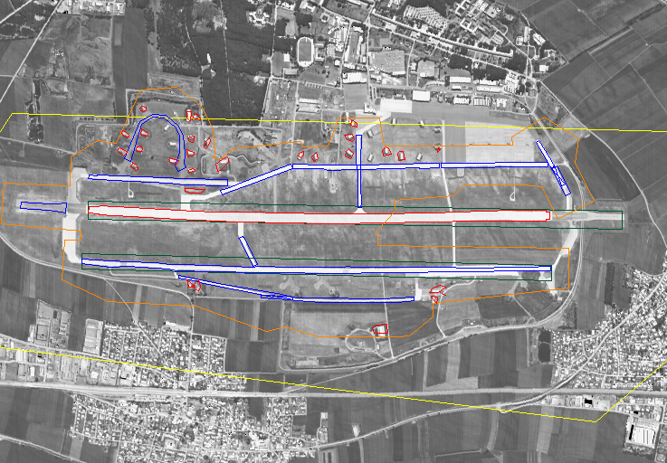
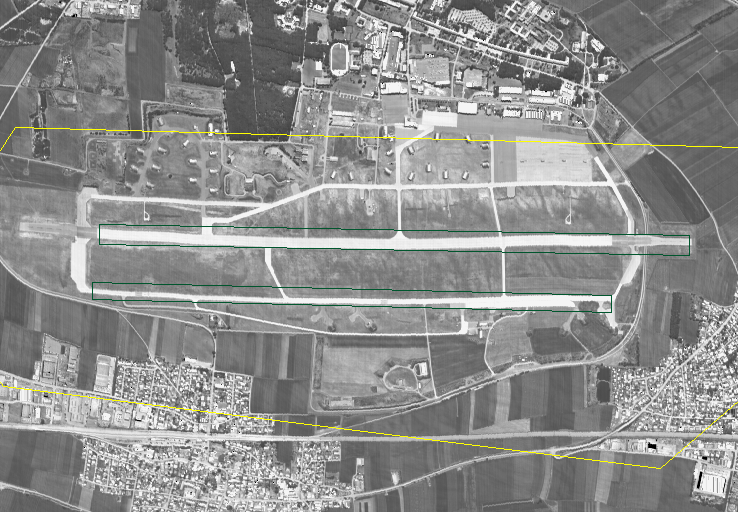
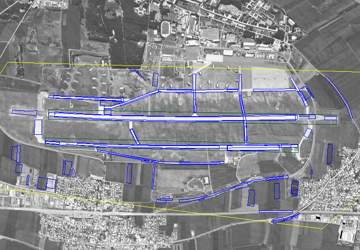
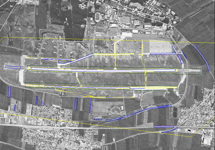
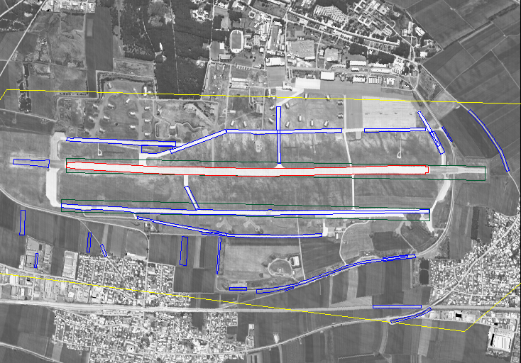
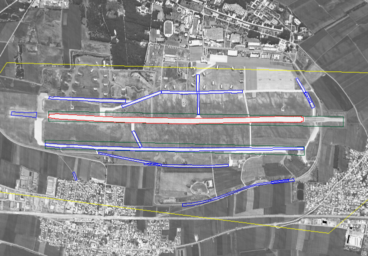
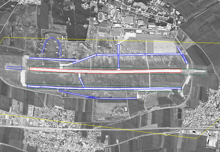
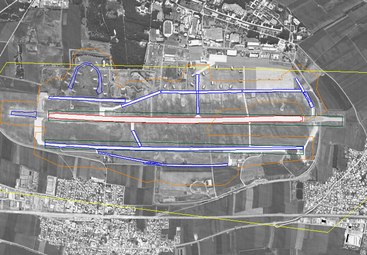
Semi-automatic interpretation using SAHARA framework
|
||
|
|
||
DLR provided the images (airborne visible, Infra-Red, SAR)
SENER was mainly involved in low level image processing (pixel fusion, image filtering, segmentation, …). Emphasis was put on the development of SAR specific algorithms.
As prime contractor, SIC was involved in all work packages including:
- collateral database creation
- blackboard and knowledge sources development (strategy module, local detector manager module,…)
- gathering of high level knowledge related to the application and introduction of that knowledge into the system
- development of local detectors needed for the application (runway, taxiway, shelter, …)
- system evaluation.
Helmut Suess: Helmut.Suess@dlr.de
Reinhard.Schroeder: Reinhard.Schroeder@dlr.de
Christoph Gierull: Christoph.Gierull@dlr.de
Javier Santamaría: Javier.Santamaria@mad.sener.es
Carlos Miravet: Carlos.Miravet@mad.sener.es
Dirk Borghys: Dirk.Borghys@elec.rma.ac.be
Pascal Druyts: Pascal.Druyts@elec.rma.ac.be
Youssef Ouaghli: Youssef.Ouaghli@elec.rma.ac.be
Wim Mees: Wim.Mees@elec.rma.ac.be
When one looks at the evolution in the field of earth observation data acquisition systems, it becomes obvious that the flux of aerial and satellite imagery will grow exponentially, whereas the number of trained photo-interpreters will not. Therefore the real challenge for computer system developers in the field of scene analysis is to build a semi-automatic system which relieves the human photo-interpreter from the routine part of his work, so that he can focus on those parts of the job for which his human intelligence and intuition are indispensable. SAHARA system is a possible layout for such a system.
The aim of the project was to show the potential usefulness of image interpretation techniques to help photo-interpreters. Typically, this could include drawing a sketch of an airport, looking for changes with respect to a reference geographic database, etc.
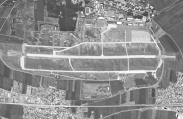
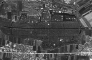
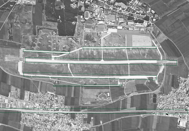
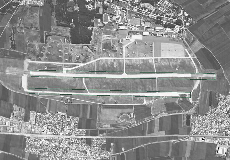
As a test case, the project was dedicated to the interpretation of airports. In this scope the main objects of interest are runways, taxiways, shelters, airplanes and buildings.
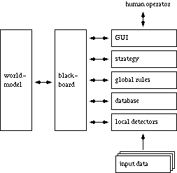
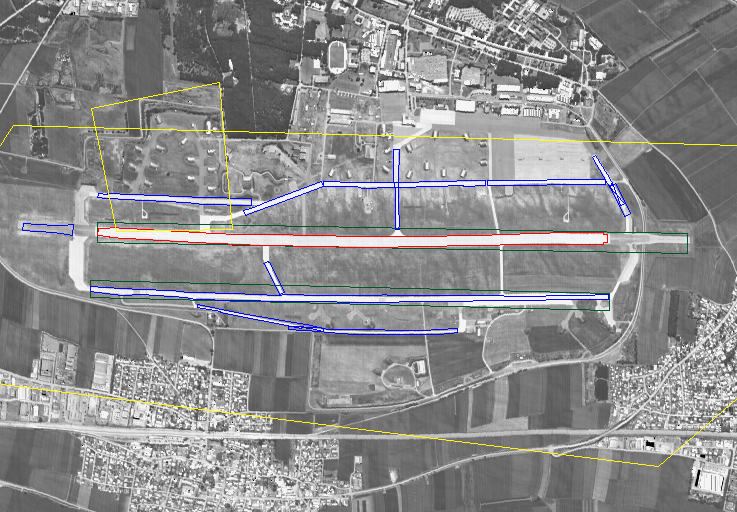
Due to the complexity of real scenes, object-related detectors are not able to solve the problem on their own. It is necessary to incorporate high level expert knowledge into the system. The proposed system makes use of a strategy to efficiently build an incremental interpretation. It also uses global rules to ensure a coherent interpretation (i.e. no building in the middle of a runway, …). Even with this high level knowledge, the system will make mistakes and it is of prime importance to allow the user to intervene at any moment to help the interpretation, by correcting errors, stopping the search in a non promising area, making the final decision on the affectation of a building, etc.
Each type of knowledge requires a different representation method.
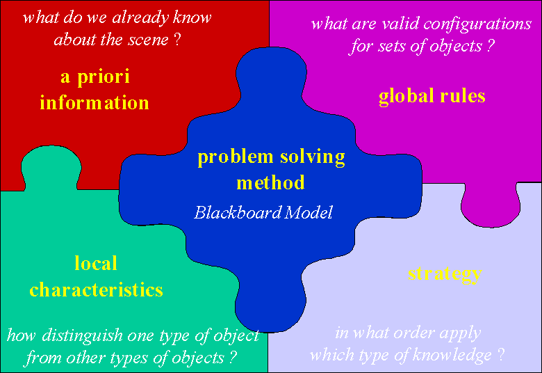
Therefore, those knowledge sources were encoded in independent modules communicating through a blackboard as shown on following figure.
During the project, an important effort as been invested in the development of an efficient Graphical User interface (GUI). This GUI allows the user to follow the interpretation and to intervene at any moment. Further developments are needed to allow the user to easily modify the strategy or the rules. Diagnostic tools to analyze the effect of a rule and eventually correct that rule are also needed.
The database contains multi-sensor/multi-spectral images of 5 airports. The images were made by degrading airborne images to simulate earth observation images that will be available in the near future for commercial satellites:
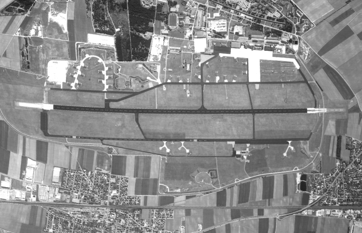


DLR provided all images for the project. The images shown here are down-sampled versions
During the SAHARA final meeting, the demonstrator was presented to the Photo-Interpreters (PI’s) of the WEU (note that some of them were involved from the beginning on to provide some user requirement and to provide the needed expert knowledge) satellite center. Discussions showed that the most promising use of the system is linked to the detection of changes (surveillance of critical areas, …).
SAHARA was funded by the Western European Union (WEU) Satellite Center.
P. Druyts, W. Mees, D. Borghys, C. Perneel, M. Acheroy, J.L. Valero, "SAHARA: Semi-Automatic Help for Aerial Region Analysis'', in ISPRS Joint Workshop, Hannover, Vol 17, pages 267-274,1997
W. Mees and C. Perneel, "Advances in Computer Assisted Image Interpretation", in Informatica - International Journal of Computing and Informatics
W. Mees, "Scene analysis: fusing image processing and artificial intelligence", in IEEE-CS looking .forward, 1997